Ecological capacity of the territory. Basic Research
Ecological capacity territory (EE) – standard value.
None of the authorities has the right to adjust the EE standard upward. In general, the determination of the EE standard should take into account the following targets:
Creating a natural environment favorable to humans and providing each person with a socially acceptable level of consumption of “environmental benefits” (recreation areas, natural reserves);
Providing conditions for the preservation and reproduction of the assimilative capacity of the natural environment.
Social factors, strategic settings of a territory or region are taken into account at the next stage, when the EE indicator moves on to the next indicator - permissible level of pollution(DUZ). The transition from EE to DZ means taking into account regional characteristics when forming an environmental strategy. This transition becomes especially important in conditions of territorial sovereignty and is the starting point of inter-republican (and interregional) relations regarding the transboundary transfer of pollution. The social and environmental policy is determined on the basis of EE, but it is based on the own goals of the social and environmental policy of republican and territorial entities. DUS is less than EE. A territorial entity, limited by administrative boundaries, has the opportunity to introduce certain specifics into an environmental strategy, but the specificity of the strategy must have its limits, consisting of the following:
Establishing the value of DZ;
Distribution of emission permits (emission licenses), establishment of emission limits if the pollution level does not exceed the maximum limit;
Regulation of the mechanism for transferring quotas provided for by an emission permit (license) from one enterprise to another (at the stage when the transition to trading rights to pollution begins).
Environmental problems are specific for areas where high-risk facilities are located: nuclear power plants, large chemical enterprises. For objects of this kind, the criterion of not increasing the level of pollution (not exceeding the maximum limit) is transformed. For territories classified as risk zones, this means that the likelihood that an accident will occur at at least one of the facilities should not increase.
Research on socio-psychological issues will allow us to assess the maximum permissible level of probability of the specified event, which can in this case be interpreted as the maximum permissible amount of risk. Based on this value, various combinations of expansion and closure of production facilities can be considered. This circumstance makes it possible to evaluate such projects separately if there is at least some likelihood of environmental risk for them. Similar to the MAC indicators, indicators of maximum permissible risk can be developed. Considering the novelty of this approach, it should be said that in this case it is necessary to distinguish between two tasks: The first is to determine the level of risk, the awareness of which does not have a significant negative impact on the mental state of people, does not itself lead to a change in a person’s health, his physical condition, perception comfort of stay. The second task is to determine the technically possible minimum degree of risk achievable under given conditions, taking into account the advanced technical level achieved in the country and abroad. The first task is socio-economic, the second is technological. We are mostly interested in the first task. The study of the population's reaction to the presence of enterprises that are objects of increased danger, carried out on the basis of a survey and other methods known in social psychology, makes it possible to identify such a threshold value of risk. Determining its exact value is a difficult task, since methods for measuring this indicator have not been developed. General safety standards and maximum acceptable risk standards should be established. Compliance with these requirements would be mandatory and compliance with them would restrain the desire to take unnecessary risks of those who are too strongly focused on achieving economic benefits. Any risk must be compensated. And the population living near the nuclear power plant has the right to similar compensation received from those who use the results of its activities, but are free from risk. The distribution of emission quotas and standard risk limits guarantees compliance with general restrictions and at the same time allows for the implementation of regional environmental conservation policies . The rest is a matter of the economic mechanism. This mechanism should facilitate the optimal distribution of emission quotas between individual enterprises. Such emissions can be acceptable due to the fact that the natural environment has assimilation potential.
28. Method of cost-benefit analysis (CBA)
According to the Russian tradition, the ADP method is also called efficiency analysis. The English spelling of the method, widely used by specialists, is cost-benefit analysis (CBA).
The modern history of the AZR goes back several decades. One of the first countries where it began to be implemented is USA. Its application was due to the adoption of a special Flood Control Act (1936), which contained a requirement to compare the benefits and costs of all water use projects. The purpose of such assessments and comparisons, in particular, was to stimulate research in the field of economics to solve problems associated with the rational allocation of budget funds. During the 50s and 60s of the 20th century, water resources management remained the main area of application of water resources management. By 1958, the publication of Otto Eckstein's work dates back to the year, in which the technical techniques of ALM were linked to the economic theory of well-being. And finally, from the turn of the 60-70s, which, in particular, was facilitated by the adoption in the United States of a special federal Act “On National Environmental Policy” (1969), research began to switch to general environmental issues. The same period dates back to an increase in interest (which has not lost its significance to this day) in specific computational procedures and techniques that underlie ADM. The distinctive features that determine both the content and the order of application of this method are as follows:
· It is based (as follows from the name of the method) on a comparison costs to carry out some environmental protection measures, implement design solutions, etc. And results from these events.
· It is based on general criteria of market efficiency, which dictate the presentation of both costs and effects in uniform monetary measures. It is also mandatory to assess the resources (costs) used within the project from the perspective opportunity cost. Thus, each resource (production factor) within the project must provide a result that is not worse in comparison with any of the possible alternatives for using this resource.
· The application of the APR method can only be carried out in a system of established and developed in society certain value ideas, including the degree of priority and urgency of environmental and natural resource needs. These value ideas are formed outside the purely market sphere and cover such issues as equality, justice in society, the preference for one or another method of distributing public goods between different social groups, as well as the costs associated with the implementation of projects and policies, taking into account the interests of future generations and etc. With the change in these value-based social imperatives, the decisions developed on the basis of the APR must also be different.
Cultural adaptation to any environment can only be understood in the context of the ancient environment and the resources and technologies available within it of the culture being studied. With this data, archaeologists can determine which livelihoods and economic options were chosen by people given the resources available and the technological ability to use them.
It is easy enough to make an inventory of the natural resources in any area, but simply listing them is not enough, since it is not only the resources themselves that are important, but how they are used, factors such as the seasons when plant food is available, the migration of game, the timing of salmon spawning . These factors, not to mention soils, precipitation, and the distribution of raw materials, determine the main element for a settlement - the ecological capacity of the territory.
The ecological capacity of a territory is the population density and the number of people a piece of land can support. This is variable and may be influenced by factors other than available resources in the region. People can change the ecological carrying capacity of their land by planting new crops that require deeper plowing and thus deplete the land more quickly. On the contrary, the introduction of fertilizers can make it possible to live sedentary in one place, because the fertility of the land is maintained artificially. It is difficult to establish the ecological capacity of a territory as it was in the past, except through experiments with verifiable (controlled) data. Current research focuses on system models and computer simulations of variables that influence ecological capacity.
One approach to studying this is analysis of the territory of real resource use, which is based on the assumption that around each settlement there is exploited area. This is an area of domestic and wild biological resources that are easily accessible on foot. The fundamental assumption is simple: the further a resource is from a settlement, the less likely it is to be used (Bailey, 1981; Roper, 1979). Two key concepts are important here: the territory of potential resource use and the analysis of the territory of actual resource use.
The territory of potential resource use is the territory from which food resources can potentially be obtained. Its boundaries are determined by the principle of least cost, that is, the maximum distance that people are willing to walk. Much depends on the nature of the resources and how they are used. Let's say that in two hours a person can walk 10 kilometers, an acceptable distance for some purpose. But a much shorter distance of 1 kilometer is more suitable when analyzing agricultural economics, when the land is used intensively, because it is more economically profitable to cultivate land near the settlement. The boundaries of such areas are determined based on the assumption of normal human behavior and from the study of the economic potential of the resources located within these boundaries. The area of potential resource use is more than just a statement of what was potentially available to the inhabitants of the monument.
The territory of actual resource use is something completely different from the territory of potential resource use (site-exploitation territory). This is the real territory from which the food resources consumed are obtained. Such areas vary in size and shape depending on the resources used, the function of the settlement and the lifestyle of its inhabitants. Obviously, the accuracy with which the area of actual resource use can be determined will depend on the accuracy with which food remains can be identified within the settlement itself.
PRACTICE OF ARCHEOLOGY
THE COLLAPSE OF THE MAYAN CIVILIZATION, COPAN, HONDURAS
The collapse of the classical Mayan civilization in the southern plains of Central America in the 9th century AD. e. is one of the most significant reasons for discussion in archaeology. Several generations of scientists passionately debate this issue. Was this decline caused by social unrest, war or economic collapse? Or did the Mayan elite demand too much from their agricultural subjects? The debate continues, characterized by the lack of reliable scientific evidence from field surveys, with the exception of a remarkable study of changing settlement patterns and population distribution in the city of Copán, Honduras (Fash, 1991; Freter, 1994).
Copan was one of the greatest Mayan cities. It was founded in a fertile valley somewhat earlier than the 5th century AD. e. On December 11, 426, a Mayan ruler named Kinich Yax Quic Mo (Sun-Eyed Green Quetzal Mako) founded a dynasty that ruled for four hundred years. Copan soon became the major city of the Maya world, with an impressive urban center covering 14.6 hectares (see Figure 9.13 and Chapter 8). The Copán state expanded significantly between 550 and 700, but the majority of its population was concentrated in and around the urban center. By 800, between 20,000 and 25,000 people lived in the Copan Valley, and then, in 822, the royal dynasty ended and the kingdom collapsed.
What could explain the fall of Copán? Archaeologists David Webster, William Sanders, and their colleagues engaged in long-term urban exploration projects decided to look at the collapse of the city in terms of the changing areas of its settlement and the changing population densities around it (Sanders and others, 1979). They designed the study, modeled after the famous Mexico City Basin Survey conducted a few years earlier, and planned to study 135 square kilometers of land around the urban center. Using aerial photography and systematic field surveys, the research team documented more than 1,425 monuments containing more than 4,500 structures. Archaeologists mapped and examined the surface of each site. Test trenches were dug at 250 sites to obtain artifacts and specimens for dating so that these sites could be included in the overall chronological framework of the valley.
As material arrived in the laboratory, scientists developed a classification of monument types by size and other criteria, ranking them in a hierarchy from simple to complex, as a method of creating a picture of changes in the use of the area. At the same time, using the obsidian hydration method to date volcanic glass fragments (see Chapter 7), they obtained 2,300 dates. This study provided a detailed picture of changes in population density as the settlement and its adjacent valley expanded.
Older monuments recorded rapid population growth, especially in the city itself and on its outskirts. The rural population was small and scattered. Between 700 and 800, the Copan Valley reached the peak of its sociopolitical complexity, with a population of 20–25 thousand. Based on these figures, based on the size of the settlement area, it can be assumed that the population doubled every 80–100 years and up to 80% of the population lived within the boundaries of the urban center and its immediate outskirts. Agricultural settlements spread towards the valley, but they were quite scattered. Farmers now cultivated the hillsides. The population density in the city was 8,000 people per square kilometer, and in the periphery it was 500 people per square kilometer. Approximately 82% of the population lived in modest dwellings, suggesting the pyramid-like structure of Copán society.
After 850 AD e. dramatic changes have occurred. In the urban center and its periphery, the population decreased by half, and the rural population increased by 20%. Small regional settlements replaced scattered hamlets in response to the cumulative destruction of forests, overexploitation of even marginal agricultural lands, and uncontrolled soil erosion near the capital. By 1150, the population of the Copan Valley had fallen by 2,000–5,000 people.
The study does not explain why the city collapsed, but it does chronicle the dramatic impact of a rapidly growing population on an ecologically fragile area. Evidence suggests that environmental degradation was a major factor in the Mayan collapse. Mayan written documents say that their rulers considered themselves intermediaries between the real and supernatural worlds. However, when the collapse of the environment became irreversible, their power evaporated, and the centuries-old way of life that maintained the harmony of the relationship between the farmer and nature was practically lost.
Analysis of actual resource use includes both the study of the territory of actual resource use and the territory of potential resource use to determine the relationship between what was potentially available and what was actually used. Determining the area of actual resource use in the past can be very difficult, since the area in modern conditions may be very different from what it was in the past. Geographic Information System (GIS) has great potential for studying the actual resource use area, as it allows elements such as topography, hill slopes, soil distribution and the like to be overlaid on access areas and distribution areas. When combined with evidence from social and cultural structures, these data can provide vivid pictures of the past.
Ecological capacity of the territory
The initial idea of the capacity of a territory is related to the ecology of animals; it is based on the concept of the feeding area of populations or individuals of a particular species of animals, including hunting and domestic ones. We can talk, for example, about the capacity of reindeer pastures, meaning the size of the area required to feed one individual of the grazing herd. Hence the concept of the capacity of the territory to transfer
went into landscape science and ecological-geographical literature, but already under the term (geosystems). Existing definitions of this concept are not clear; in particular, their authors avoid direct reference to the relationship between the ecological capacity of the landscape and humans or limit themselves to vague references only to recreational capacity, leaving it without decoding.
Meanwhile, the growing tension in the relationship between man and the natural environment raises the urgent question of the existence of some natural limit for satisfying human needs at the expense of natural landscapes, or a kind of threshold “capacity” of the latter in relation to the people inhabiting them. In the 70s. last century, interest in this issue arose among geographers from different countries, which is due to the direct relationship of the ecological capacity of the territory to the global food problem - one of the most pressing humanitarian and at the same time environmental problems of our time.
When talking about the ecological capacity of a territory, we must mean not an abstract geometric surface, but real geosystems with their ecological potential. Therefore, in this case, the most accurate term should be considered ecological capacity of the landscape(EEL). EEL in relation to humans can be defined as the population per unit area that the landscape is able to support with its natural resources without compromising its own functioning. The integral measure of EEL is the calculated value of some optimal population density, the criteria of which require scientific justification.
Concept ecological capacity of the landscape expresses the relationship between two blocks of the landscape-population system and, in a certain sense, a compromise between them. It was previously noted that in the course of historical development, a conflict inevitably arises and intensifies between growing human needs and relatively stable, to some extent limited natural resources of the landscape, more precisely, the ecological potential (EPL). A person has two options for overcoming this conflict: 1) adapt to the natural environment and moderate their needs to some extent; 2) force the landscape, by actively influencing it, to increase its useful output. The first path historically quickly exhausted itself, the second led to changes in the EPL, but not in the direction of a general increase, but mainly in the direction of restructuring the structure (increasing the share of a useful product in the biological productivity of the landscape) and, as a rule, was accompanied by negative side environmental consequences .
Ecological capacity of the territory - concept and types. Classification and features of the category "Ecological capacity of the territory" 2015, 2017-2018.
Environmental regulation of economic activity is included in the concept of eco-development as the most important part. Its basis is the principle of balanced environmental management, according to which the placement of economic facilities in a certain territory and their total technogenic load on the environment (nature intensity) should not exceed the ecological technical intensity of the territory, the restoration potential of its ecosystems, including the population of the territory. This principle and the comparison of natural and production potentials (capacities) act as the main criteria for environmental regulation and optimization of environmental activities.[...]
Ecologically permissible load is human economic activity, as a result of which the threshold of ecosystem sustainability (the maximum economic capacity of the ecosystem) is not exceeded. Exceeding this threshold leads to disruption of stability and destruction of the ecosystem. This does not mean that in any given area this threshold cannot be exceeded. Only when the sum of all environmentally permissible loads on Earth exceeds the limit of the “economic capacity” of the biosphere, will a dangerous situation (ecological crisis) occur, which will lead to degradation of the entire biosphere, changes in the environment with serious consequences for human health and the sustainability of its economy. [... ]
Ecological capacity is the quantitatively expressed capacity of the habitat (the number of individuals per unit of territory, the limits of the environment’s capabilities during the economic development of the territory, etc.), allowing the ecosystem to exist without damage to its constituent components. [...]
LAND CAPACITY - a measure of the number of people or animals that can use a certain territory without disturbing it for an indefinitely long time (for people - recreational capacity). ECOLOGICAL CAPACITY - see Landscape ecological capacity.[...]
The ecological capacity of a territory is the maximum possible biological productivity of all its biogeocenoses, arpo-, and urban cenoses under the specific conditions of a given area, taking into account the optimal composition of representatives of the flora and fauna for a given area. The indicator of the territory's capacity is associated with the development of a whole system of restrictions (maximum permissible indicators) on the environmental load on natural complexes and their resistance to anthropogenic influences (demographic and economic development, pollution by certain sectors of the national economy, the nature of the functional use of the territory, etc.).[ .. .]
Ecological (landscape-ecological) capacity of the territory - correspondence of the population size to the natural resource potential of the territory (landscape).[...]
The ecological technical capacity of a territory is only part of the total ecological capacity of the territory. The full ecological capacity of a territory as a natural complex is determined, firstly, by the volumes of the main natural reservoirs - the air basin, the totality of reservoirs and watercourses, land areas and soil reserves, biomass of flora and fauna; secondly, the power of the flows of the biogeochemical cycle that renew the contents of these reservoirs - the rate of local mass and gas exchange, replenishment of clean water volumes, soil formation processes and biota productivity.[...]
The ecological technological intensity of a territory is a generalized characteristic of a territory, quantitatively corresponding to the maximum technogenic load that a set of recipients and ecological systems of a territory can withstand and tolerate for a long time (years) without disturbing their structural and functional properties. The ecological technical capacity of a territory is only part of the total ecological capacity of the territory.[...]
Assessing the ecological capacity of a territory is one of the urgent tasks of environmental and economic research, without solving which it is impossible to develop a scientifically based system of environmental regulations. In the history of this problem, the works of P. P. Semenov-Tyanypansky (1881), A. I. Voeikov (1926) and other authors are known, devoted to determining the demographic capacity of territories in connection with the possibility of their settlement. With an increase in the concentration of production and the acceleration of urbanization, the concept of territorial capacity becomes more complicated, the concepts of economic population density, density of industrial production assets, etc. are introduced: etc.[...]
The principle of the environmental imperative imposes certain restrictions on the adoption of management decisions on risk management based on environmental considerations. These considerations are based on the fact that measures and actions to improve the quality of life and maximize its duration should be carried out taking into account the ecological capacity of the biosphere and the ability of the natural environment of the territories to adapt harmful impacts.[...]
The development of environmental (environmental) standards and criteria is based on the indicator of the ecological capacity of the territory.[...]
Neglect of the basic environmental comprehensive standard in engineering and economic practice is fraught with serious environmental miscalculations. In 1990, the then head of the State Committee for Nature Protection, N. N. Vorontsov, complained that “concepts such as the ecological capacity of a territory were not used at all until recently. We will build up metallurgy there using Donetsk coal, without considering whether the land and people can withstand it or not.” And further he noted: “Of course, we need to improve the filters of dust and gas collectors and purify wastewater. But we still did not have the main thing - the ideology of resource conservation, the definition of ecological capacity, the biosphere approach."[...]
In this sense, forest ecosystems in the water areas of small and large rivers and coastal areas of the northern and eastern seas are very ecologically vulnerable. The situation is also aggravated by the fact that state planning and management does not take into account the real ecological capacity of the territory, and the technogenic load implemented at the federal and local levels is not brought into line with the real mechanisms of self-regeneration of ecosystems subjected to anthropogenic influence.[...]
The statement about the vastness of the territory of Russia and, in connection with this, about the presence of a very large capacity for accommodating the population and economic facilities is incorrect, since a significant part of the undeveloped or poorly developed territories of the country (60-65%) is located in cold climate areas where permafrost is widespread and photosynthetic production is very low. The zone of relatively favorable climatic conditions with the highest level of photosynthetic production has already been populated, developed and occupied by tens of thousands of economic objects. Thus, in the presence of physical space, there is an ecological shortage of territory. Therefore, proposals to redistribute productive forces to the east for environmental reasons seem simply dangerous in the existing conditions of a severe environmental crisis. It is necessary to realize that in the presence of physical space, ecological space is completely exhausted.[...]
It is important to note that in areas with very high environmental stress over a significant part of the territory, anthropogenic impact goes beyond the ecological capacity of the environment, and in areas with high environmental stress the ecological capacity has been exhausted.[...]
And there are standards that make it possible to identify the demographic capacity of an area depending on the environmental characteristics of water resources. The territory for the construction of a new city or other settlement or reconstruction of an existing city is determined taking into account the available water resources.[...]
The implementation of the principle of balance and the development of norms and means of environmental regulation of economic activity require a real comparison of technogenic load with the stability of the entire natural complex of the territory, the stability of environmental quality and the condition of recipients. It is believed that the requirement of proportionality implies a limitation on industrial development. Unfortunately, many business managers, production organizers and entrepreneurs still perceive the tasks of environmental protection and balanced use of natural resources. But in reality we are talking about something else - about limiting the nature-capacity of production.[...]
However, a sharp influx of recreational tourists can lead to negative environmental consequences. The results of assessing the EHS of the area show the following picture. The total capacity of tourist routes should not exceed: walking - about 10 thousand people with 150 days of the season and three groups (20-25 people) per day, water - about 3 thousand people with 150 days of the season and three groups of 5 6 people per day.[...]
Depending on the correspondence of the level of human economic activity to the ecological capacity of the territory, environmental management can be divided into extensive and equilibrium.[...]
Exceeding the maximum permissible technogenic load combines the majority of environmental and environmental-economic problems of many territories. Apparently, for various natural production complexes there should be normative gradations of such excess. Thus, the problem of measuring the natural and production potentials and capacities of territories develops into the problem of environmental regulation.[...]
In most countries of the world, the prevailing methods of management do not take into account the real ecological capacity of the territory, and the technogenic load is not normatively linked to the capabilities of real mechanisms of self-regeneration of ecosystems. The key problem still remains the question of the relationship between Ecology and Business. Until business becomes ecologically civilized, the question of survival on Earth will not be resolved in favor of Homo Sapiens. To a large extent, the necessary conditions for the survival of civilization are provided by engineering ecology - a science that determines the measure of rationality of human labor activity. Engineering ecology is responsible for the optimal management of the planet's technosphere in the aspect of global security. In practical terms, environmental engineering forms industrial and technological solutions to ensure a sustainable compromise between nature and society at the local, regional and global levels. Therefore, the improvement of engineering ecology as a complex scientific and technical discipline should be carried out in a cycle of continuous advancement and qualitative development.[...]
Expertise bodies must accumulate and use positive information about the characteristics of territories, their ecological capacity, the environmental compliance of various objects, products, technologies, etc., including information from regional banks of environmental and economic information. But experts should not get carried away with specific constructive recommendations, so as not to replace the functions and responsibilities of design organizations.[...]
When considering these data, it should be borne in mind that a “favorable” indicator for a large territory does not at all mean the absence of environmental problems, since local areas or zones with disturbances of soil and vegetation cover, with excessive recreational load, with significant anthropogenic pollution of soil and water bodies. The same consideration, applied to a city with a large excess of environmental technology intensity, indicates the existence of high-risk zones. They really exist on the territory of Tolyatti. The unfavorable environmental situation has developed as a result of the very rapid extensive development of the industrial city without taking into account the ecological capacity of the territory. And although it was quite large, the powerful diversified industrial hub quickly exhausted the self-restorative potential of the excellent natural landscape, forming a city with a hypertrophied industrial function (Moiseenkova, 1989).[...]
Foreign firms are attracted to Russia by the relative cheapness of land and other natural resources, the large ecological capacity of our territories, powerful scientific and technical potential, low cost of qualified labor, etc. At the same time, the creation of enterprises in new organizational and legal forms (especially with private form of ownership) has led to an increase in the level of threat to the environment due to the sometimes predatory attitude of their owners towards natural resources and the desire to extract maximum benefit as quickly as possible. The press has repeatedly reported that, under the guise of international environmental cooperation, some domestic commercial organizations, taking advantage of loopholes in the legislation, tried to place hazardous waste from foreign enterprises on Russian territory, even in resort areas.[...]
The amount of pollutant emissions from enterprises within the established standards should not exceed the ecological capacity of the territory. If it is exceeded, it is necessary to withdraw individual enterprises from the given territory or repurpose them.[...]
Classification of environmental protection and restoration work. Efficiency of restoration of natural landscapes. Ecological capacity of territories.[...]
Neglect of permissible norms of anthropogenic load in engineering and economic practice is fraught with serious environmental miscalculations. Until recently, the concept of “ecological capacity of a territory” was not used at all. For example, when creating the economic complex “coals of Donbass - ores of Krivoy Rog,” no one thought about whether the land and people would withstand it or not, i.e. the main thing was missing - the ideology of resource conservation, the definition of ecological capacity, the biosphere approach.[...]
The potential ability of the natural environment to tolerate one or another anthropogenic load without disrupting the basic functions of ecosystems is defined by the term “capacity of the natural environment,” or the ecological capacity of the territory.[...]
Thousands and thousands of people are ready to emigrate. This turns our country into a source of potential social and socio-ecological conflicts. Meanwhile, the development of the territory of the former USSR in some places is much lower than beyond its borders. The country's ecological capacity is far from being exhausted. With serious elaboration of environmental plans (eco-development) and the inclusion of self-regulation mechanisms in the “nature - man” system, the state could well emerge from the state of crisis, including the environmental one. However, every year this opportunity decreases.[...]
The vast majority of labor activity processes have a direct impact on the geological environment. This is especially true for the development of mineral resources, industrial development of territories, construction and operation of industrial facilities and structures. The mechanism of influence of technology and technological processes on the geological environment is very complex and depends on many factors: specific power and scale of technogenesis, ecological capacity and sensitivity of the territory, conditions of self-regeneration, etc. [...]
In the plant world, as a rule, there is a maximum filling of space and the use of solar energy while maintaining reserves of mineral nutrition. The limiting factors are the physical occupancy of the territory, the flow of radiation energy, previous events materialized in the processes of soil formation, the plants’ own influence on the environment (for example, allelopathy) and complex relationships with representatives of other kingdoms of nature - microorganisms, fungi and animals. There are no preventive mechanisms for self-regulation of population density. However, there is a powerful lever for its restoration in case of thinning - the soil reserve of seeds, dormant buds, etc. And in parallel with this, there is a genetic mechanism for limiting the size of individuals. Otherwise, one plant would be able to occupy the entire area and there would be no room for duplication processes as a tool to ensure system reliability. The capacity of the habitat is used by plants as fully as possible within the framework of a set of environmental restrictions. Their main biotic mechanism is transferred to the area of interaction of their own sizes, interspecific relationships and individual impact on the living environment. The free supply of matter and energy is minimal. Basically, factors directly dependent on the population density of the population operate. [...]
No country in the world has such a set of potential prerequisites for a successful movement towards sustainable development that Russia has. This is, first of all, the wealth of natural resources, the scale of living space and the ecological capacity of the territory, the level of development of basic industries, education and science, the nature of the national culture and spiritual world, historical roots, etc. [...]
For the natural block, the main criterion is stable bioproductivity with maximum resistance of ecosystems to anthropogenic impacts. Fulfillment of these requirements ensures the achievement of the main condition of balance: the environmental intensity of production does not exceed the ecological technological capacity of the territory. Coefficient of measurement [...]
Undoubtedly, the future development of the city will be the more successful the more accurately it is possible to predict its functional structure and choose a development trajectory that takes into account the trends of its change. At the present stage, the study of problems of the development and functioning of cities in interaction with their environment, which largely determines the scale and specificity of its development, is of particular relevance. Moreover, the impact of the city should not exceed the threshold of the ecological capacity of the surrounding territory, which is largely capable of neutralizing its negative impact. The experience of environmental analysis of the city and territory shows that most often a separate study of the city territory and its surroundings is carried out, while these objects are in constant interaction.[...]
One of the central elements of economic methods of regulating environmental activities is the natural scientific justification of the maximum permissible loads on the natural environment, which is based on a quantitative assessment of the values of the assimilation potential and its presentation as a resource, with the subsequent use of its valuation in economic calculations. At the same time, as an approximate approximation of the assimilation capacity of various regions and territories, the calculated values of the limits on MPE, MAP, etc. are often taken, successive iterations of which as a result can contribute to a more objective assessment of it. In this case, the assimilation potential will be expressed as a system of environmental standards, which, on the one hand, are a quantitative characteristic of environmental needs, and on the other hand, parameters characterizing the costs of preserving such a resource as the quality of the natural environment.[...]
Each of the “blocks” of the ecosystem is largely azonal - due to the predominance of the processes of cultivation and reclamation of man-made soil structures and certain agricultural techniques for caring for plants. They obviously differ from natural ones, in which natural factors of self-regulation and natural selection predominate. The vegetation of such artificial ecosystems has a high diversity of ornamental species that are stable in urban conditions, both native and introduced. The sustainability of biodiversity is supported not only by the selection of resistant species, but also by the peculiarities of planting placement, which ensure the maximum ecological capacity of the territory for fauna.
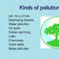 Presentation in English "environmental problems" Presentation in English environmental problems
 What interferes with creativity Types and functions of creativity
 Tutorial: Using visual aids in the process of learning the numbers of the first ten