Egp of africa over time. Mining in Africa
Summary of a lesson in geography (Grade 11)
Subject: African countries. South Africa: EGP, population, economy.
Target:
Educational: to form in students an idea of the EGP of African countries; population and features of the sectoral and territorial structure of the economy; look at the political map; characteristics of the population.
Developing: to improve the skills of working with a map and with sources of geographic information when compiling the characteristics of industries and regions; continue to form practical skills for processing and analyzing the information received.
Educational: to bring up the importance of studying geography, curiosity.
Equipment: Map of Africa, atlases, physical map of the world, handout.
Lesson type: learning new knowledge.
During the classes
1. Organizational moment.
2. Reporting the topic, goals, objectives of the lesson and motivational activities.
Each region is unique in its own way: for example, Eurasia is the largest continent, North America is the wettest continent, Australia is the driest continent. Africa is a continent of shrouds and jungles, hot deserts and mountains with snowy peaks. It is the variety of associations associated with Africa that determines our perception of the "dark continent" as something mysterious, indefinite.
3. Learning new material.
Territory - 30,221,532 km²
Population 1.1 billion people
Density 30.51 people/km²
Names of inhabitants - Africans
Includes 55 states
Africa is the second largest continent after Eurasia. Its area is 30.3 million km2. Most of the mainland is located in the Northern Hemisphere. Africa, like other fragments of Gondwana, has a massive outline. It does not have large peninsulas and deep bays off its coast.
Africa is the hottest continent. It has the world's largest desert, the Sahara, in the north of which, in Libya, the highest temperature on the planet was recorded: +58°C.
CHARACTERISTICS OF THE ECONOMY OF THE COUNTRIES OF AFRICA
| EGP features | Natural resources |
| It is washed by the Atlantic and Indian oceans. Long coastline (30 thousand km). Proximity to Europe and the Middle East. Location in both hemispheres. | Mineral resources: one third of world reserves (2nd place in deposits of gold, diamonds, chromium, manganese; 2nd place - copper, uranium, graphite; 3rd place - oil, gas). Water resources: distributed unevenly. Forest and land resources: significant forest resources (10% of the world's forests). The soil is not fertile. |
STRUCTURE OF THE INDUSTRY
| Metallurgy | Energy | mechanical engineering | Chemical | Other |
||
| Black: 80% of Africa's copper is South Africa. Also: Egypt, Algeria, Libya, Zimbabwe. Color: aluminum (South Africa, Egypt, Cameroon, Ghana), Copper (Zambia, South Africa), zinc (Morocco, Tunisia, Libya). | Oil refining (South Africa, Egypt, Nigeria, Gabon, Algeria, Libya). Electricity: Africa: | With the exception of South Africa (heavy, agricultural, wagon, ship repair), the industry is almost not developed. Machine tool industry (Egypt, Algeria, Morocco). | Mineral fertilizers, organic. Rich resource base. The main production area is South Africa. | Food: many export crops. Textile: cotton (Egypt, Nigeria, Morocco, Sudan, Kenya, Algeria, South Africa). The extractive dominates. |
||
| Agriculture | Transport |
|||||
| animal husbandry | crop production | It is poorly developed, the paths are concentrated near the mining industries. Horse-drawn transport (camels) is developed. The most developed maritime transport: Alexandria, Algeria, Casablanca, Dakar, Lagos, Mombasa. |
||||
| Beef cattle breeding (Somalia, Djibouti). Sheep breeding (South Africa, South Africa). Camel breeding (Sahara, Lesotho). Fisheries (Morocco, Senegal, Mauritania) | Export: cocoa (Côte d'Ivoire, Ghana), coffee (Ethiopia, Uganda, Côte d'Ivoire), peanuts (Sudan, Senegal, Gambia, Nigeria), palm oil (Western and Equatorial Africa), cotton (Egypt, Sudan, Tanzania) , grapes (South Africa), cinnamon and vanilla (Seychelles), etc. Small commodity sector (for themselves): yams, taro, bagat, millet, sorghum, wheat, rice. |
|||||
POPULATION
The population of Africa is about 1.1 billion people. Population growth for 2004 was 2.4%. Over the past 50 years, the average life expectancy has increased from 39 to 54 years.
Among the world religions dominated Islam and Christianity(the most common denominationsCatholicism, Protestantism, lessorthodoxy, Monophysitism). Also living in East AfricaBuddhists and Hindus(many of them come fromIndia). Followers also live in AfricaJudaism and Bahaism. Religions brought to Africa from outside are found both in pure form andsyncretizedlocal traditional religions. Among the "major" traditional African religions areifa or bwiti.
SOCIO-ECONOMIC CHARACTERISTICS OF SOUTH AFRICA
| Chart plan | South Africa |
| State form. rights | Parliamentary republic |
| S territories | 1.2 million km 2 |
| Population | 4.9 million people |
| Average population density | 41 people/km 2 |
| Urban population | |
| ethnic structure | 79.4% - Africans 2.6% - Indians and Asians |
| Demographic situation | Eating. growth - 0.4% Young mortality - 43.2% 0 |
| Share of young and old | |
| Unemployment rate | 23% for (2010) |
| Extractive industry | The mining industry is well developed. South Africa is a major exporter of minerals. The country is the world leader in platinum, gold and chromium mining. South Africa is among the leaders in the extraction of diamonds, manganese, titanium, uranium, iron ore, vanadium, coal (one of the major exporters). Copper, nickel, antimony, asbestos, lead, and phosphate rock are also mined. |
| Manufacturing industry | Power industry (93% - thermal power plants, hydroelectric power plants - on the Orange River). Automotive industry (BMW, Toyota, Mazda, Hummer). Mechanical engineering (mining equipment). Chemical (petrochemistry, production of acids, alkalis, soda, mineral fertilizers). Light industry, non-ferrous metallurgy (copper smelting), woodworking, production of building materials, food industry. |
| Agriculture | Cereals, sugarcane, citrus fruits, cotton, corn, wheat, oats and sorghum and grapes are grown. Bred: MRS, sheep, goats and cattle. |
| Grow international specialization | Mining industry, car assembly, metal structures, mechanical engineering. |
| Transport | The densest network of railways and roads. Main seaports: Cape Town, Durban, Port Enuabot, Richards Bay. International airports: Johannesburg, Cape Town and Pretoria. |
| Non-manufacturing sphere | 4% - agriculture; 31% - industry; 65% - service sector (tourism, education, art) |
| Metals, diamonds, cars and transp. equipment, wine, wool, fish. |
|
| Oil, food, chemical goods. |
4. Generalization and systematization of the studied material.
Exercise 1.
Conversation.
What features of the EGP of individual subregions of Africa affect the development of their economy?
What explains the unequal population distribution in Africa?
Why is the ethnic composition of the population of most African countries is heterogeneous.
What factors testify to the economic backwardness of African countries?
What social and economic problems should African countries solve in the near future?
Task 2.
Use the textbook to determine:
The most developed industries of African countries;
The level of development of energy and manufacturing industry;
Promising industries.
Task 3.
Map work.
Using the World Population Atlas map, name the areas of Africa that are most and least densely populated.
5. The result of the lesson.
6. Homework. Presentation on the topic: "Culture of Africa".
>>Geography: We give a general description of Africa
We give a general description of Africa
Africa covers an area of 30.3 million km 2 with a population of 905 million people (2005). There is no other continent in the world that would suffer as much from colonial oppression and the slave trade as Africa. By the beginning of the twentieth century. the whole of Africa turned into a colonial continent, and this largely predetermined its backwardness.
After the Second World War, the colonial system was gradually eliminated, and now on political map continent 54 sovereign states (with islands). Almost all of them belong to the developing ones. The Republic of South Africa belongs to the type of economically developed states.
In key indicators of economic and social development, Africa lags markedly behind other major regions, and in some countries the gap is even widening.
1. Territory, borders, position: great internal differences, political system.
The territory of Africa stretches from north to south for 8 thousand km, and from west to east for a maximum of 7.5 thousand km. African countries are generally larger than European countries.
Example. The largest country in Africa is Cydan (2.5 million km 2). It is 4.5 times larger than the largest European country, France. Algeria, DR Congo, Libya, Angola, Ethiopia, South Africa also surpass France in area by two to three times.
Different criteria can be used to evaluate the GWP of African countries. One of the most important is the presence or absence of access to the sea. No other continent has such a number of countries - 15, located far from the seas (sometimes at a distance of 1.5 thousand km), as in Africa. Most of the inland countries are among the most backward.
In terms of the state system, African countries differ much less: only three of them (see Table 2 in the "Appendices") retain a monarchical form of government, the rest are republics, and almost all of them are presidential. However, under the republican form of government, military, dictatorial political regimes are often hidden here.
Coups d'etat are also very frequent here. .
Africa is another region of widespread territorial disputes and border conflicts. In most cases, they arose in connection with the borders inherited by the countries of this continent from their colonial past. Acute conflicts of this kind exist between Ethiopia and Somalia, Morocco and Western Sahara, Chad and Libya, and others. Along with this, Africa is also characterized by internal political conflicts, which have repeatedly led to lengthy civil wars.
Example. For several decades, the civil war in Angola continued, where the opposition group (UNITA) opposed the government political group. Hundreds of thousands of people died in this war.
To help strengthen the unity and cooperation of the states of the continent, preserve their integrity and independence, counteract neo-colonialism, the Organization of African Unity 1 was created, which was transformed in 2002 into the African Union . (Exercise 1.)
2. Natural conditions andresources : the most important factor in the development of African countries.
Africa is exceptionally rich in a variety of minerals. Among other continents, it ranks first in reserves of ores of manganese, chromites, bauxites, gold, platinoids, cobalt, diamonds, and phosphorites. In addition, the mineral raw materials are of high quality, and are often mined in an open pit.
Example. The richest country in Africa is South Africa. Its subsoil contains almost the entire known set of fossil resources, with the exception of oil, natural gas, and bauxite. The reserves of gold, platinum, and diamonds are especially large. .
But there are countries in Africa that are poor minerals and this hinders their development. (Task 2.)
African land resources are significant. There is more cultivated land per inhabitant than in Southeast Asia or Latin America. In addition, so far only about 1/5 of the land suitable for agricultural production is being cultivated on the continent. However, land degradation in Africa has also taken on a particularly large scale. As early as the 1930s, the Belgian geographer Jean-Paul Gappya wrote a book about land degradation in Africa called Africa a Dying Land. Since then, the situation has deteriorated significantly. Africa accounts for 1/3 of all drylands in the world. Almost 2/5 of its territory is at risk of desertification.
1 The Organization of African Unity (OAU) was established in 1963. It included 51 African countries. The headquarters of the OAU was in Addis Ababa. In 2001-2002 The OAU, following the model of the European Union, was transformed into the African Union (AU), within the framework of which it is planned to create an all-African parliament, a single bank, a currency fund and other supranational structures.
Africa's agro-climatic resources cannot be unambiguously assessed. You know that Africa is the hottest continent on Earth, so it is fully provided with heat supplies. But water resources are distributed over its territory extremely unevenly. This has a negative impact on agriculture, and on the whole life of people. So the catchphrase "Water is life!" refers to Africa, probably in the first place. For its arid parts, artificial irrigation is of great importance (so far only 3% of the land is irrigated). And in the equatorial belt, on the contrary, the main difficulties for life and economic activity are created by excessive moisture. The Congo Basin also accounts for about 1/2 of Africa's hydropower potential. .
In terms of total forest area, Africa is second only to Latin America and Russia. But its average forest cover is much lower. In addition, as a result of deforestation, which exceeds natural growth, deforestation has assumed alarming proportions. (Task 3.)
3. Population: features of reproduction, composition and distribution.
As you already know, Africa stands out worldwide with the highest rate of population reproduction. This is largely due to the long tradition of having many children. In Africa they say: “Not having money is a disaster. But not having children means being doubly poor.” In addition, most countries of the continent do not pursue an active demographic policy, and birth rates here remain extremely high.
Example. In Niger, Chad, Angola, Somalia, and Mali, the birth rate reaches 4,550 babies per 1,000 inhabitants, i.e., it is four to five times higher than in Europe, and more than 2 times higher than the world average. In Ethiopia, Mali, Uganda, Benin, there are 7 or more children per woman.
Accordingly, African countries are also leading in terms of natural population growth (see Table 13 in the "Appendices").
That is why, despite the fact that Africa is still the region of the highest mortality, its population is growing very rapidly. Consequently, Africa is still in the second phase of its demographic transition. This means maintaining a very high proportion of children's ages, further aggravation of the problems of employment, education, and health care. In addition, the quality of the population in Africa is the lowest: over 1/3 of adults are illiterate, more people are getting AIDS. . The average life expectancy for men is 51 years, for women - 52 years.
Many problems are connected with the ethnic composition of the population of Africa, which is very diverse. Scientists ethnographers distinguish 300-500 ethnic groups and more on the continent.
Some of them, especially in North Africa, have already formed into large nations, but most are still at the level of nationalities; remnants of the tribal system are also preserved.
Like foreign Asia, Africa is a region of numerous ethnic, more precisely, ethno-political conflicts, which flare up with the greatest severity from time to time in Sudan, Kenya, the Democratic Republic of the Congo, Nigeria, Chad, Angola, Rwanda, Liberia. Often they take on the character of a real genocide 1 .
Example 1 As a result of the civil war in Liberia, which began in the late 80s, in a country with a population of 2.7 million people, 150 thousand people died, more than 500 thousand were forced to leave their habitats and another 800 thousand people fled to neighboring countries.
Example 2 In 1994, an acute conflict arose between the Tutsi and Hutu tribes in rural Rwanda. As a result, 1 million people died, the number of refugees within the country ranged from 500 thousand to 2 million people, and another 2 million people were forced to flee to neighboring countries.
In general, Africa accounts for about half of all refugees and displaced persons in the world, and in the vast majority these are precisely “ethnic refugees”. Such forced migrations always lead to outbreaks of famine, epidemics, and increase infant and general mortality.
It is also a legacy of the past that the official (official) languages of most African countries are still the languages of the former metropolises - English, French, Portuguese. .
The cultural heritage of Africa is very great. This oral folk art is folklore, this is monumental architecture that originated in ancient Egypt, this is arts and crafts that preserves the traditions of ancient rock art. Almost every people in Africa has its own musical culture, retains the features of singing and dancing, musical instruments. Since ancient times, there have been theatrical rites, rituals, ritual masks, etc. In Africa, 109 World Heritage Sites have been identified (see Table 10 in the "Appendices"). Among them, objects of cultural heritage prevail, but there are also many natural objects. .
The average population density in Africa (30 people per 1 km 2) is several times less than in foreign Europe and Asia. As in Asia, it is characterized by very sharp contrasts in settlement. The Sahara contains the largest uninhabited territories in the world. Rare population and in the zone of tropical rainforests. But there are also quite significant clumps of population, especially on the coasts. Even sharper contrasts are characteristic of individual countries.
1 Genocide (from Greek glIos - clan, tribe and Latin cado - I kill) the extermination of entire population groups along racial, national, ethnic or religious grounds.
Example. Egypt is, one might say, a classic example of this kind. In fact, almost all of its population (about 80 million people) lives on the territory of the Nile delta and valley, which is only 4% of its total area (1 million km 2). This means that there are about 2,000 people per 1 km 2 here, and less than 1 person in the desert.
In terms of urbanization, Africa still lags far behind other regions. This applies both to the share of the urban population, and to the number of large cities and cities with a population of millions. In Africa, the formation of urban agglomerations is just beginning. However, the rate of urbanization here is the highest in the world: the population of some cities doubles every 10 years.
This can be seen in the growth of millionaire cities. The first such city in the late 20s. 20th century became Cairo. In 1950 there were only two of them, but already in 1980 there were 8, in 1990 - 27, and the number of inhabitants in them increased from 3.5 million to 16 and 60 million people, respectively. At the beginning of the XXI century. In Africa, there were already 40 agglomerations with a population of more than 1 million people, which concentrated 1/3 of the urban population. Two of these agglomerations (Lagos and Cairo) with a population of over 10 million people have already entered the category of "super-cities". But such a manifestation of the "urban explosion" has a number of negative consequences. After all, it is mainly capital cities and "economic capitals" that are growing, and growing thanks to a constant influx of rural residents who have no means of subsistence and huddle in the outlying slums.
Example. Recently, Lagos in Nigeria has become the second most populated city in Africa after Cairo. Back in 1950, its population was not even 300 thousand people, and now (within the agglomeration) it has exceeded 10 million! However, the living conditions in this overpopulated city (besides, founded at one time by the Portuguese on a small island) are so unfavorable that in 1992 the country's capital was transferred from here to another city - Abuja.
Of the individual subregions of the continent, North and South Africa stand out in terms of urbanization. In Tropical Africa, this level is lower. But in terms of the exaggeratedly high proportion of capital cities in the urban population, some of the countries of Tropical Africa are unmatched. .
Despite the scale of the "urban explosion", 2/3 of Africans still live in the countryside. (Task 4.)
4. Economy: sectoral and territorial structure, Africa's place in the world.
After gaining independence, African countries began to make efforts to overcome centuries of backwardness. Of particular importance were the nationalization of natural resources, the implementation of agrarian reform, economic planning, and the training of national personnel. As a result, the pace of development accelerated. The restructuring of the sectoral and territorial structure of the economy began.
In the sectoral structure, the share of industry and non-production spheres increased. Nevertheless, in most countries the colonial type of sectoral structure of the economy is still preserved. Its distinguishing features are: 1) the predominance of low-commodity, low-productive agriculture, 2) the weak development of the manufacturing industry, 3) the strong backlog of transport, 4) the limitation of the non-productive sphere, mainly trade and services. The colonial type of sectoral structure is also characterized by one-sided economic development. In many countries, this one-sidedness has reached the level of monoculture.
Monocultural (mono-commodity) specialization - a narrow specialization of the country's economy in the production of one, as a rule, raw material or food product, intended mainly for export.
Monoculture is not only a natural phenomenon, but also a historical and social one. It was imposed on African countries during the colonial period. And now, as a result of such narrow international specialization, the whole life of dozens of countries is dependent on world demand for one or two exported goods - coffee, cocoa, cotton, peanuts, oil palm fruits, sugar, livestock, etc. Monoculture countries are striving to create a diversified economy, but so far only a few have been successful along this path.
That is why the place of Africa in the world economy is determined mainly by two groups of industries. The first of these is the mining industry. Today, in the extraction of many types of minerals, Africa holds an important, and sometimes monopoly place in the world (see table 8). Since the main part of the extracted fuel and raw materials is exported to the world market, it is the extractive industry that primarily determines the place of Africa in the international geographic division of labor. The second sector of the economy that determines Africa's place in the world economy is tropical and subtropical agriculture (see Table 8). It also has a pronounced export orientation. (Task 5.)
There have also been some changes in the territorial structure of the African economy. Along with areas of high-value crop production and extensive pasture cattle breeding, several rather large areas of the mining industry have already formed the axis. However, the role of the manufacturing industry, largely handicraft, in creating the geographical pattern of its economy is still small. Transport infrastructure also lags behind.
On the whole, in terms of the level of its social and economic development, Africa ranks last among the major regions of the world. Sub-Saharan Africa's share of the world GDP is only 1.2%.

In the 80s. The socio-economic situation in Africa has deteriorated especially, turning into a deep crisis. The pace of development has slowed down. The gap between food production (annual growth of about 2%) and the needs of the population (an increase of 3%) has widened: as a result, grain imports have increased. In addition, Africa suffered an unprecedented drought that affected more than half of the countries of the continent and directly affected 200 million people. Africa has also found itself in the grip of indebtedness to Western countries. That is why it has been increasingly referred to as the "calamity continent".
East Africa. Economic and geographical characteristics
Table of contents
- Introduction
- General information
- Geographical position
- Natural conditions and resources
- Region population
- General information
- Demographic situation
- Economy of East Africa
- General information
- Agriculture
- Transport
- External links
- Conclusion
- Bibliography
Introduction
East Africa is a region of the world distinguished on the one hand by magnificent natural resources and attractions, on the other hand, one of the poorest regions in the world. Most of the countries in the region have a clearly agrarian-oriented economy. The exception is Zambia, which has an export-oriented economy based on the mining industry (extraction and export of copper).
The region occupies a large territory. This area is home to a significant portion of the African population. Therefore, the task of describing and studying this region is of particular relevance.
Thus, the purpose of this work was to study and analyze the current economic situation in the region, taking into account the specifics of the spatial organization of both the resources of the economic system and the location of its main nodes.
General information
The East Africa region is located in the eastern part of the mainland and includes 10 states (Figure 1, Table 1) - Djibouti, Eritrea, Ethiopia, Kenya, Malawi, Seychelles, Somalia, Tanzania, Uganda, Zambia.
Table 1 - Composition of the East Africa region
The total area of the region is 4,561,190 km2. The region has a population of 153,741,344 (2005).
Geographical position
The region is characterized by a fairly favorable geographical position. In economic terms, the region is located among the states characterized by a rather underdeveloped economy. However, in relation to the main mineral resource bases, the region has a rather advantageous position - in the northeast (Arabian Peninsula) and west (Gulf of Guinea) there are the richest oil and gas deposits, in the south there is a continuation of Africa's largest copper belt. In terms of transport, the region occupies a fairly advantageous position - proximity to the Suez Canal and the Red Sea provides quite significant potential benefits. In geopolitical terms, the situation is somewhat worsened by the situation among the poor countries of Africa, which are characterized by an extremely unstable political situation.
Figure 1 - East Africa: composition of the region
Natural conditions and resources
Tectonic and geomorphological conditions. Mineral resources
Tectonic-geomorphologically, the region is heterogeneous. The Ethiopian Highlands (Ethiopia, Eritrea) is a highly elevated block of the African Platform, which is characterized by high tectonic fragmentation and a variety of landscapes due to a clear separation of structural and morphological regions and altitudinal zonality. According to the degree of potential development, the region is difficult to access and poorly developed. The Somali Plateau in the east of the region is much smaller and much less indented, greatly increasing the potential for development. The East African Plateau (Kenya, Tanzania, Uganda) is a mobile, tectonically active part of the African Platform. The greatest rift system and the greatest heights of the mainland are concentrated here. The region is characterized by extremely difficult terrain and low levels of potential development.
In terms of the availability of mineral resources, the region belongs to the medium-provided region. There are no fuel and energy resources (natural gas, oil). An exception is the hard coal deposits in southwestern Zambia.
Metallic minerals are represented sufficiently. Gold deposits are located in the south of Ethiopia, in the west of Uganda, in the south of Zambia. A separate link in the spectrum of metallic minerals is copper ore. Widely known and of international importance is the so-called Copper Belt of Central Africa, which ends in Zambia. In addition to deposits of high-quality copper ore, deposits of polymetals (cobalt ores, nickel ores) are confined to this belt.
Non-metallic minerals are represented by diamond deposits in Tanzania (the Mwadui deposit), table salt (the border between Eritrea and Ethiopia).
Climatic conditions and agro-climatic resources
The region is climatically located in the subequatorial zone (a zone of sufficient moisture in the west, insufficient moisture in the east of Tanzania). The far north of Ethiopia, Tanzania and Eritrea lies in the tropical zone with an arid climate (Figure 2).
In agro-climatic terms, the region is confined to the tropical zone, characterized by continuous vegetation of plants throughout the year (it can only be interrupted by a dry period for a subequatorial climate with insufficient moisture). The tropical zone is characterized by the possibility of collecting several crops per year. Most of the region is within the isotherm of the sum of the air temperature for the period with temperatures above 10С more than 8000С. Under these conditions, heat-loving perennial and annual crops with the longest growing season (sugarcane, coffee, cocoa, cinchona, rubber plants, etc.) can be grown. The eastern part of Ethiopia and western Tanzania, as well as western Kenya and eastern Uganda are within the isoline air temperatures for a period with temperatures above 10 C from 4000 C to 8000 C. These areas belong to the subtropical agro-climatic zone and are characterized by the possibility of growing heat-loving temperatures with a very long growing season (cotton, late corn, olives, citrus fruits, tobacco, tea, sometimes date palm, etc. .).
Hydrological conditions and water resources
There are no major rivers in the region. However, small rivers, descending from the plateaus, develop a sufficiently high speed, which characterizes their hydropower potential as acceptable for the construction of hydroelectric power stations.
In terms of water resources, the region belongs to the poor enough ones. Ethiopia, Tanzania, Eritrea and Somalia are characterized by the availability of total river flow resources of 2.5 - 5 thousand m 3 per year, Kenya - 0.5 - 2.5 thousand m 3 per year. Zambia is characterized by the most favorable conditions for the provision of full river flow resources (10 - 25 thousand m 3 per year).
The region has the largest lakes on the mainland - Victoria, Nyasa, Tanganyika. The lakes have significant recreational potential, which is intensively used.
Vegetation and fauna. Land resources
The region is characterized by the presence of 3 natural zones - humid equatorial forests (west of the region), subequatorial forests and woodlands (Zambia, Malawi), wet savannahs (along river valleys), typical savannahs (Ethiopia), deserted savannahs (Somalia, Kenya).
In connection with the above, the land resources of the region are mainly grazing (this is due to the large spread of savannahs). Fragmentary there are forests that do not have an industrial value. Land suitable for cultivation has a small distribution.
east africa economic geographical
Figure 2 - Climatic zones of East Africa
( I - equatorial climate; II - Subequatorial climate: 1a - with sufficient moisture, 1b - with insufficient moisture; III - tropical climate )
Figure 3 - East African Land Resources
Region population
General information
The population of the region is 153,741,344 people (2005). The average population density is 33.7 people. / km 2. The largest population is typical for Kenya - 53,142,980 people, the smallest - for the Seychelles (73,000 people (2005).
Table 2 - Population density in East African countries
The highest population density is typical for the Seychelles, which is associated with a small area of the state. The average indicators for states are small and poorly reflect the real situation.
Demographic situation
Birth rates in the region are quite high. The northern states of the region are characterized by birth rates from 40 to 45 ‰, for the southern states - from 45 to 50 ‰. At the same time, mortality rates are also high - from 15 to 20 ‰. The natural increase in the population of the region for the southern countries of the region is more than 30‰, for the northern - 25 - 30‰.
In the age and sex structure, women predominate, only in Kenya and Uganda there is a predominance of the male population.
Ethnic structure of the population
The southern part of the region is inhabited by the peoples of the Niger-Kardofan family of the subgroup of the central Niger-Congo - the peoples of Rwanda, Rundi, Kongo, Luba, Malawi, etc. The peoples of the Kushite group of the Afroasian family - Oromo, Somali, Afar, Beja, etc. live in Ethiopia and Somalia. West The region is inhabited by representatives of the Eastern Sudanese group of the Nilo-Saharan family - Nubians, Dinka, Kalenjin, etc.
Thus, the ethnic structure of the studied region is characterized by considerable diversity.
Placement of the population. Urbanization
The region is rather unevenly populated. In the center of Ethiopia, in certain regions of Kenya, in the coastal zone of Lake Victoria, the population density reaches 100 - 200 people. per km 2. The rest of the region is rather poorly populated - the population density is from 1 to 10 people. per km 2.
The region belongs to the least urbanized parts of the world - the level of urbanization for most countries is from 10 to 20%. The exception is Zambia. Zambia is one of the most urbanized countries in Africa, about 44% of its population is concentrated in large cities and urban industrial agglomerations.
Economy of East Africa
General information
Leading role in Ethiopian economy played by consumer agriculture. In the early 1990s, more than half of the gross domestic product (GDP) came from agricultural production. During the same period, the share of trade and services in GDP grew. From 1989-1990 to 1994-1995 financial years, the annual growth in the share of services in GDP was 2.4%. In fiscal year 1993-1994, the service sector accounted for 22% of GDP (data include economic indicators for Eritrea). Until recently, Ethiopia was one of the poorest countries in the world, and its economy developed slowly. In the period from 1960 to 1974, the average annual growth in production did not exceed 4%. Revolutionary upheavals led to the fact that this figure in 1974-1979 fell to 1.4%. Due to rapid population growth, per capita output in 1985-1995 decreased annually by an average of 0.3%. During this decade, the population growth rate averaged 2.6% per year. Severe droughts and civil war also greatly affected the deterioration of living conditions. In the early 1990s, there were signs of an economic recovery. From 1989-1990 to fiscal years 1994-1995, the average GDP growth rate was 1.9%. In fiscal year 1996-1997, GDP increased by 7%. The main factor in improving the economic situation was foreign loans and financial assistance.
Economy Zambia depends on world prices for copper - the main export product of the country. In the 1960s and 1970s, copper export earnings enabled the government to maintain a relatively high standard of living (compared to many African countries). As a result of a significant increase in the cost of importing oil, a significant drop in world prices for copper and the mistakes of the economic policy of the government of K. Kaunda, Zambia already in the 80s faced a whole range of financial and economic problems. The inept implementation in the 90s of the IMF's programs for the structural restructuring of the economy led to an increase in unemployment and a further increase in inflation. The government of L. Mwanawasa is making efforts to curb negative trends in economic development. There is a process of privatization of state-owned companies. According to official government data, 257 (out of 280 scheduled for transfer into private hands) state and semi-state enterprises were privatized in 1991-2002. Zambian entrepreneurs acquired 56% of the privatized companies. In 2001-2002, foreign investments in the country's economy exceeded 100 million US dollars annually. Zambia receives financial assistance from the IMF under two programs - PRGF (a program to help fight poverty and accelerate economic growth, it received 110 million US dollars in 2002) and HIPC (a program for the most heavily indebted poor countries, it received 155 million in 2002 .3 million USD). In January 2003, L. Mwanawasa unveiled a national development transition plan through 2005.
Somalia - economically backward and poor country. It has scarce mineral resources, the basis of the country's economy is mainly nomadic and semi-nomadic animal husbandry. About 80% of the able-bodied population is employed in agriculture, mainly in animal husbandry; the sale of live cattle, meat products and skins brings the country over 80% of the total amount of export earnings. The share of industrial production in the national economy is very insignificant, and mineral resources do not pay off the costs of their development. Two factors adversely affected the state of the country's economy in the second half of the 1970s: first, a severe drought, which significantly reduced the number of livestock, and then the war with Ethiopia, as a result of which a stream of up to one million refugees poured from Ethiopia into Somalia. Even more damage was done to the country's economy by the inter-clan struggle that unfolded after the overthrow of the Siad Barre regime in 1991.
Kenya- an agricultural country, but its economy is different from the economy of many other countries in Africa. Kenya has not one but several export crops, a modern tourism industry and a strong manufacturing industry. During the colonial period, trade and commercial agriculture were in the hands of Europeans and Asians. The government of independent Kenya contributed to the strengthening of the role of Africans in all these areas.
The model of socialism adopted in Tanzania after gaining independence, was based on two basic principles - self-reliance and equal distribution of social wealth. Implementation of this model was fraught with great difficulties and proved untenable mainly due to the focus of the Tanzanian economy on the export of agricultural products. Despite the arid climate and other adverse natural conditions, agriculture is the backbone of Tanzania's economy.
In the 1970s, the country's economy developed at a relatively fast pace, which was associated with high world prices for Tanzanian export products. The policy of forced creation of "socialist villages" led to the alienation of the peasants from the land, and the rate of growth slowed down. In the late 1970s, Tanzania entered a period of economic crisis. The fall in world prices for Tanzanian exports, the global oil crisis and the burdensome war with Uganda led to a balance of payments disruption. Domestic political factors also played an important role. The state systematically underpaid the peasants for export products and accumulated a significant part of the income from exports. Therefore, the peasants faced a dilemma: either to produce less products, or to sell a significant part of it on the black market. The economy of the socialist type also assumed the presence of political restrictions on economic activity. The Arusha Declaration of 1967 forbade party functionaries and government officials from engaging in entrepreneurship and using hired labor. Despite the efforts of the Tanzanian leadership to prevent the personal enrichment of the party elite and civil servants, the economic crisis of the 1980s gave rise to a large-scale shadow economy. Party workers and government officials, faced with the inability to live on their salaries, took up entrepreneurial activities. Experts note that it is difficult to objectively assess the state of the Tanzania economy, since it is almost impossible to determine the scale of the shadow economy.
In the early 1980s, the Tanzanian government made several attempts to adjust economic policies, but this did not help the ailing socialist economy. In 1986, Tanzania negotiated with the IMF in order to obtain loans for the restructuring of the country's economy. The agreement reached meant a radical change in the economic course of the country, since the conditions for granting loans provided for the rejection of socialist methods of management. Like most reform countries, Tanzania is privatizing the public sector of agriculture and industry. The IMF also demanded trade liberalization and devaluation of the Tanzanian shilling. In recent years, as a result of the curtailment of social programs, the peasants have lost state support, and now they have to rely only on themselves.
Tanzania is still a predominantly agricultural country, with 85% of the rural population employed in the agricultural sector. In 1997, agricultural exports accounted for 60% of all export earnings. Although the IMF has named Tanzania as a successful economic restructuring country, the actual results are at best half-hearted. For the majority of peasants, production oriented to the domestic market often does not even provide a living wage.
Throughout the 19th century main exports Uganda were ivory and animal skins. Completion in 1901 of the construction of a railway line from Mombasa on the coast of the Indian Ocean to Kisumu (in present-day Kenya) on Lake. Victoria has reduced the cost of transporting exported goods. Missionaries and the protectorate's colonial authorities experimented with growing several crops. The choice was made in favor of cotton. Its first harvest was obtained in 1904, and in the next decade the collection increased so much that from 1915 the British Treasury stopped subsidizing the administrative apparatus of the protectorate.
At the same time, the authorities strongly encouraged the development of plantation farms of white settlers, who specialized in the production of rubber and coffee. By 1920, there were over 200 such farms in Uganda with a total area of 51,000 hectares, although almost three-fourths of these lands were not cultivated. When in 1920-1921 there was a fall in world prices for rubber and cotton, many white settlers were on the verge of bankruptcy and ceased production. In this situation, at the beginning of 1923, the authorities decided to support the small farms of African peasants. Thus, unlike Kenya and Zimbabwe, Uganda avoided many of the problems associated with the dominance of white settlers in the economy. In the 1920s, African farmers in Uganda began growing coffee, and in the 1950s the crop became a major source of export earnings, pushing cotton into the background.
During the colonial period and the first decade after independence, the government played a key role in economic planning. In the 1950s, major infrastructure projects such as the Owen Falls power station on the river were built by the government or with its participation. Victoria Nile in the Jinji region and the Kilembe copper pyrite mine in the far west of the country. The government created public corporations to fund development projects and streamlined cooperatives, disbanding those that were organized without a government license. Through the creation of state cooperatives, African farmers have been able to accumulate enough funds to purchase coffee processing and cotton ginning enterprises. During the period of independence, both legally elected and military representatives of Uganda significantly expanded the public sector and the scope of state regulation of the economy. This process continued until the late 1980s, when the government of the National Resistance Movement (DNM) began to reduce the regulatory role of the state in the economy: it stopped the practice of setting purchase prices for agricultural raw materials and initiated a program of selling state-owned enterprises into private hands. The government of the DNS abandoned the administrative regulation of the exchange rate of the national currency.
In 1971-1986, the national economy was destroyed by the pernicious policies of the military regime of Idi Amin and two wars that were fought within six years after the overthrow of the dictatorship. The expulsion of Indians from Uganda, who owned 90% of private sector enterprises, carried out in 1972 on the orders of Amin, practically destroyed it. During the reign of Amin, the economy continued to degrade due to the lawlessness that prevailed in the country, the expropriation of private property, the inability of the government to pay off the peasants for export products and maintain roads in order. The 1979 war, which toppled Amin's dictatorial regime, led to widespread looting that did as much damage to the economy as Amin's rule itself. The process of returning to civilian rule led to a new war in the central part of the country, which created serious obstacles to economic recovery. This entire period was characterized by rising inflation, corruption and domestic political instability. An economic revival began in the 1990s.
Seven months after coming to power, the Musaveni government began to pursue an economic course focused on the restoration of the public sector. This led to inflation unprecedented in the history of Uganda. In 1987, Uganda agreed to an economic restructuring program proposed by the World Bank for Reconstruction and Development. Up until 1999, the government generally adhered to the recommendations of international financial institutions.
In 1987-1997, Uganda achieved impressive economic success: the average annual GDP growth was at the level of 6%. In 1997 Uganda's GDP was approx. 6.5 billion dollars, and the annual income per capita - 320 dollars, which, taking into account purchasing power, exceeded 1,500 dollars. The share of money income was 77% of GDP. Thanks to strict and consistent economic policies, annual inflation dropped from 200% in 1988 to 6-10% in the mid-1990s. A significant incentive for investment in commercial agriculture in the 1990s was the road construction program. By 1999, the country had largely approached or even surpassed the level of crop production (with the exception of cotton) achieved in 1972.
Fuel and energy complex
Ethiopia has a powerful hydropower potential, which is estimated at about 60 billion kWh, which, however, is practically not used.
In the 70s Zambia completely self-sufficient in electricity and even began to export it to neighboring Zimbabwe (then Rhodesia) and the Democratic Republic of the Congo (then Zaire). Several power plants were built - Kafue George, Kariba North, etc. However, the share of wood is about 50% of the fuel and energy balance of Zambia. Only 17% of the population is provided with electricity. Residents of most villages and even cities still use wood and charcoal for cooking and heating their homes. The Government attaches high priority to the electrification of rural areas. In 1998, the World Bank approved a $75 million loan to finance a project to modernize the Zambian energy industry.
In 1989 in the energy balance Kenya about 80% was wood, and among the remaining 20%, a significant part was oil, which was imported from the United Arab Emirates. Currently, 14% of the electricity required by the country is supplied by hydroelectric power plants on the river. Tana. Other power plants run on petroleum products; in addition, a geothermal station operates in the Olkaria region. A small amount of energy comes from the Owen Falls hydroelectric plant in Uganda. As a result of the widespread use of wood as an energy source, forest area decreased by 11% between 1975 and 1990. Forests are cut down to use the vacated land for arable land, and the wood is used for fuel and used in housing construction.
90% of the energy needs of the population and small enterprises Uganda are met by wood, mainly charcoal. In 1999, the capacity of the Owen Falls hydroelectric power station was increased from 180 to 240 thousand kW (in 1996, due to a decrease in domestic demand for electricity, it was reduced to 60 thousand kW). Uganda has no oil refining industry at all. In 1996, oil imports cost the country $91 million.
mining industry
Bosom Ethiopia poorly studied. Gold mining, mainly from poor deposits in the south and west, has long been a side industry for the local population. Since the late 1960s, the development of rich gold deposits near Kybre-Mengist (Adola) in the state of Sidamo has contributed to the growth of production of this metal. In the 1970s, gold production declined, but in 1986 it amounted to 923 kg. Recently, a gold deposit with a capacity of about 500 tons was discovered in the Laga-Dembi place in the Wallega region. Iron ore is mined and processed on a modest scale. Significant deposits of iron ore and coal have been discovered in the areas of Wallega, Illubabor and Shoa, but development has not yet come to fruition there. There are reports that the subsoil of Ethiopia, primarily in the Ogaden and Gambel, contains significant reserves of oil and gas, and exploration work has been carried out there since the late 1980s. Table salt is mined in the country, but it is not enough to meet domestic needs. Deposits have been explored or mining is underway on a small scale of other minerals: copper, sulfur, potassium salt, platinum, oil, marble, mica, cinnabar and manganese.
The mining industry began to develop in Zambia even during the colonial period. The mining of copper ore is the main industry. A significant part of the Copper Belt (Copperbelt) is located on the territory of the country. Potentially the richest copper deposits are located near the Konkola area, which has 44.4 million tons of ore reserves. By 1969 the country had become the world's leading producer of crude copper. However, by the mid-1970s, copper smelting and income from its exports had noticeably decreased (due to falling copper prices on the world market). In 1996, the mining industry accounted for 10.8% of GDP and employed about 10% of the entire workforce. Extraction of purified copper in 2002 amounted to 309.7 thousand tons, and cobalt - 3.8 thousand tons. According to the Central Bank of Zambia, copper exports in 2002 amounted to 303.9 thousand tons (in 2001 - 271.8 thousand tons). The growth in production and export of copper is caused by the demand for it from China. In 2002, a new copper deposit was discovered in Solwezi, the reserves of which are estimated at 481 million metric tons. Cobalt, zinc, lead, gold, silver, selenium, and marble are mined from other minerals in the country. Emeralds, aquamarines, amethysts and a small amount of diamonds are mined. Zambian malachite is widely known in the world, especially the most valuable of its species - turquoise. In the mid-1990s, a significant proportion of the emeralds on the international market were of Zambian origin. In 1992, a new diamond deposit was discovered in the Western Province, in 2002 - in the Eastern Province. According to the department of geology, De Beers specialists have discovered about 100 kimberlite pipes in Zambia over the past 30 years. A serious problem for the government is the illegal export of precious stones. In 1999, about 70% of Zambian emeralds were taken out of the country illegally.
Uganda has limited mineral resources. Reserves of copper ore are estimated at 4 million tons, reserves of nickel, gold, tin, tungsten, bismuth and phosphorites are much less. Copper ore deposits in the Rwenzori mountain range were intensively exploited until 1979, when work was stopped due to falling world copper prices and the unstable situation during the reign of Amin. In 1970, 17 thousand tons of copper were produced. It is planned to annually extract up to 1 thousand tons of cobalt from dumps formed over many years of copper pyrite mining. In the southwestern part of the country, deposits of other minerals are being developed on a small scale. Foreign companies conducted gold prospecting in the northeast and southeast of Uganda and oil exploration at the bottom of lakes Albert and Edward.
Manufacturing industry
Manufacturing industry in Ethiopia underdeveloped, and in the 1993-1994 financial year, the share of its products in GDP was only 7%. Mainly there are enterprises for processing agricultural products and light industry. The main products of the manufacturing industry are textiles, food (sugar, flour, pasta, biscuits, canned meats and tomatoes), beer, shoes, cement, soap, alcoholic beverages, medicines and vegetable oils. Artisans make clothes, wood crafts, carpets and jewelry. Many manufacturing industries are concentrated near the urban centers of Addis Ababa, Harare and Dire Dawa. In 1975 the government nationalized 72 industrial enterprises and acquired the majority of shares in 29 enterprises. Industrial development is hampered by a shortage of electricity.
The development of industry depends on investments, primarily foreign ones. In order to attract foreign investors, a government decree was issued in 1950, according to which all new enterprises were exempted from paying taxes for the first five years. The decree provided that capital equipment could be imported into Ethiopia without paying customs duties, that the participation of the Ethiopian side would be kept to a minimum, and the investor had the right to transfer foreign exchange profits from Ethiopia abroad in proportion to the capital invested.
In 1975 the government nationalized large industrial enterprises, as well as banks, financial institutions and insurance companies. The socialist policy of the government provided for the functioning of three sectors in the Ethiopian economy. The main branches of industry, natural resources and public utilities have passed into state ownership. The mixed public-private sector included mining, paper and plastics, construction of large facilities, tourism, i.e. those areas that Ethiopia could not develop without the participation of foreign capital. The third sector of the economy, representing an extensive field of activity for private capital, included wholesale, retail and foreign trade, land transport, except for the railway, the food industry, the hotel business, and small enterprises of various profiles. At the same time, many private firms were nationalized.
The average annual growth rate in the industrial sector decreased from 6.4% in 1965-1973 to 3.8% in 1980-1987. From 1989-1990 to 1994-1995 financial years, the average annual growth rate of industrial production was 1.6%. However, there have been positive developments in the industry in recent years. Its share in GDP in the 1993-1994 financial year increased to 7.1%, and in the 1994-1995 financial year - up to 8%. Although the state still owns and operates some large industrial and commercial enterprises, the government has increased private investment in the economy and limited the economic role of the state.
Manufacturing industry in Zambia It is represented by several factories for the processing of agricultural raw materials, the production of beverages, cigarettes and paper. Trucks of Toyota, Mitsubishi and Volkswagen brands are assembled in Ndola.
Somalia is mainly engaged in the processing of agricultural raw materials (production of canned meat, sugar refining, leather tanning). Textile factories use local and imported cotton. Among the new industries are cement and oil refineries. About 4/5 of the country's industrial enterprises are included in the public sector of the economy. Industry employs 6% of the economically active population.
underdeveloped manufacturing industry Uganda significant damage was done during the years of internal political instability. Despite the growth of manufacturing in 1987-1997 from 5% to 9%, it still makes up an insignificant part of GDP. The country is forced to import most of its industrial products. Uganda's economy is highly vulnerable and dependent on world prices for the goods it exports and imports. The largest enterprises are factories for processing agricultural products: coffee, tea, sugar, tobacco, edible oils, cereals, milk and cotton. In addition, there are facilities for the production of beer and soft drinks, car assembly plants, textile factories, a copper and steel mill, cement, soap, shoes, furniture and animal feed factories. The work of many enterprises is disorganized due to the lack of spare parts, interruptions in the supply of raw materials, unsatisfactory transport and low productivity. Nevertheless, the textile industry has significantly increased output.
Agriculture
The temperate climate, fertile soils and abundant rainfall in most of the Ethiopian highlands create favorable conditions for the development of agriculture in Ethiopia. The main crops are wheat grown at higher altitudes in cooler climates, corn, millet and cereals grown at lower altitudes, as well as crops such as durro (a type of sorghum), teff (a type of millet with small grains, used for baking bread) and dagussa (from which black bread is baked). Coffee is an important export crop. In the 1994-1995 financial year, its share in export earnings was 66%. A significant part of the coffee crop is harvested on plantations in the state of Kefa. Other crops are cotton, date palm, sugar cane, beans and peas, oilseeds, chat (the leaves of which contain the drug), castor beans, fruits and vegetables.
Agriculture is a vital industry for Ethiopia. In 1996, it employed 85% of the working-age population, and agricultural production accounted for more than 50% of GDP. Most of the peasants run a consumer economy, many of them are nomadic pastoralists. At least half of the country's land is suitable for agriculture, including vast unused land in the south. In early 1975, the military government nationalized all land in the countryside, promising to distribute it among the peasants. The area of a private individual land plot should not exceed 10 hectares, the use of hired labor was prohibited. Peasant associations were created by government decree to carry out land reform. One such association united an average of 200 peasant households, initially the associations were given the right to resolve all land issues. Later, their powers were significantly expanded, including judicial functions (minor administrative and criminal offenses), maintaining order, and exercising local self-government. In 1979 the government announced plans to transform peasant associations into collective agricultural production associations.
The 17 years of Derg's rule had a detrimental effect on the agricultural sector. Labor productivity has plummeted due to the regime's attempts to force collectivization and set low state purchase prices for agricultural products. The implementation of programs to create new villages and the forced resettlement of peasants disorganized social and economic life in the Ethiopian village. The EPRDF, which overthrew the dictatorial regime of Mengystu Haile Mariam in May 1991, abolished state control over prices for agricultural products. The transitional government gave farmers the right to set minimum guaranteed prices for their crops. However, the authorities retained public ownership of the land.
Most of the territory of the Ethiopian plains, due to the lack of irrigation, is suitable only for pasture cattle breeding. Herds of cattle (mainly zebu), sheep and goats, as well as horses, donkeys and mules (the latter are highly valued as a vehicle for transporting goods and people), accompanied by shepherds, wander from place to place in search of food. Even despite the mediocre quality of the dressing, hides and skins are an important export item. In 1996, Ethiopia had about 30 million cattle, 22 million sheep, 16.7 million goats, 5.2 million donkeys, 2.75 million horses, 630,000 mules and 1 million camels. .
Since ancient times, important caravan routes passed through the territory of Ethiopia. The development of modern modes of transport began with the construction of the Franco-Ethiopian railway from Djibouti to Addis Ababa (since 1981 it became known as the Ethiopian-Djiboutian). Upon completion of construction in 1917, its length was 782 km (including 682 km in Ethiopia).
Zambia- agricultural country. Agriculture employs 50% of the economically active population. The area of fertile land is 47% of the country's territory, but only 6% is cultivated. A variety of climatic conditions makes it possible to grow many crops: corn, cassava, wheat, millet, melons, fruits, cotton, sorghum, soybeans, tobacco, sunflower, rice, etc. Due to the growth in the 90s of fruit exports to Europe at a rapid pace horticulture develops. Cattle breeding is developed in the southern and central regions. The country is dominated by subsistence farming. Relatively few farms producing marketable products (several hundred large plantation farms owned and managed by Europeans). The productivity of African peasant farms is extremely low due to backward agricultural technology, infertile soils and frequent droughts. Frequent droughts cause serious damage. Agriculture is inefficient, the country is forced to import food (mainly corn). In 2003 (for the first time in the last 10 years) an unprecedentedly high corn crop was harvested - 1.1 million tons.
Somalia forced to buy abroad significant amounts of food, primarily grain. Animal husbandry - breeding of cattle, camels, goats and sheep - is widespread in the northern and central regions of the country. Farming is developed in the southern regions, where important crops such as corn, sorghum, cassava, sesame, citrus fruits, sugarcane and cotton are grown. The only export crop is bananas, which are cultivated in the valleys and interfluves of the Jubba and Webi Shabelle. Crop development in much of Somalia is hampered by a lack of irrigation and drought protection measures.
The main branch of the economy Uganda is agriculture. With the exception of sugar cane, which is grown on plantations, all other crops are cultivated on small farms. For most of them, the hoe remains the main tool of labor, mechanization tools are rarely used. The main part of the products produced by the peasants is consumed by their families, the rest is sold on the domestic market or exported. Famine often occurs in different parts of Uganda, but in general the country is self-sufficient in food. The main crops are bananas in the south and west, millet or corn in the west, north and southeast, cassava in the northwest. Sweet potatoes, sorghum, legumes are grown everywhere.
Coffee is cultivated mainly in the central and western regions of the country. In 1996, a record export volume of this crop was recorded - 250 thousand tons. In 1997, 18.3 thousand tons of tea were exported. The main tea production area is the west of Uganda. In the same year, the export of tobacco grown in the northwest amounted to 9.2 thousand tons. Cotton is grown throughout the country, but the most favorable conditions for it exist in the north and east. In 1996, 20.7 thousand tons of cotton were harvested - significantly less than in the early 1970s. In 1997, the number of cattle amounted to 5.5 million heads, sheep - 1 million and goats - 6.3 million heads. Fishing is carried out in inland waters, in 1996 222 thousand tons were caught. In the 1990s, new freezing plants were built, which made it possible to export fish.
Despite the expansion of agricultural exports in the 1990s, coffee still remains the main export item. The production of traditional export crops - tea and tobacco - is gradually being restored, the collection of which fell sharply in the 1970s. If in the 1980s the share of coffee in exports was 95%, by 1998 it had dropped to 56%. The reason for this should be sought both in the increase in exports of tea (4%) and cotton (3%), and in the emergence of new export items - fish (7%) and gold (5%). Most of the gold comes to Uganda from the Democratic Republic of the Congo. In the 1990s, government investment was directed towards creating markets for grains, legumes, cut flowers, sesame, cocoa and vanilla.
From 1987 to 1997, the share of agriculture in GDP fell from 55% to 43%. As peace returned to much of the country, many Ugandans who used to rely on subsistence agriculture to support themselves are now free to devote themselves to other pursuits. Nevertheless, the share of food crops in total agricultural production in 1997 was 58%. The export of agricultural products, fish and skins in the same year provided the country with approx. 90% of foreign exchange earnings.
Transport
Before the start of the Italian occupation in Ethiopia several highways were built, the Italians left behind many new roads. During the Italo-Ethiopian war, transport infrastructure, especially bridges, suffered significant damage, and the repair of roads and their maintenance fell heavily on the state budget. The imperial government was well aware of the role of reliable communications in strengthening the central government and consolidating the country. In 1995, the total length of paved roads was 23.8 thousand km. The expansion of the road network was financed from the state budget and foreign aid. In 1995, the Ethiopian government announced the start of a road construction program, which was subsidized mainly by loans from the EU and the World Bank.
After the Second World War, a merchant marine fleet was created, and air transportation began. Aircraft of the Ethiopian state airline fly to all states of the country, and also connect Addis Ababa with the countries of Europe, Asia and Africa. In 1989, the volume of air transportation carried out by the Ethiopian airline was almost half that carried by all other African airlines. There are three international airports in the country (in Addis Ababa, Bahr Dar and Dire Dawa), domestic airports are available in all administrative centers and a number of large cities. The creation of civil aviation was made possible thanks to loans provided to Ethiopia by the US Export-Import Bank and the American Development Fund. Other types of transport services include intercity bus routes and transportation by boats on the Tana and Abay lakes and along the river. Baro. After Eritrea left Ethiopia in May 1993, the country lost the ports of Massawa and Assab on the Red Sea. However, the Eritrean government granted Ethiopia the right to use the port of Assab for receiving humanitarian aid to the starving and for foreign trade operations.
An integral part of the modernization of Ethiopia was the expansion of internal telephone communications. The first telephone lines were laid during the reign of Emperor Menelik II and later, primarily during the Italian occupation, the telephone network was significantly expanded. Since the early 1950s, the telephone and telegraph have connected Ethiopia with other countries in the world.
At the time of independence (1964) Zambia had one railway line and a single paved road. In 2003, the total length of railways was 2.24 thousand km. Two major railway lines, the Zambia Railways network, cross the country from north to south and link to National Railways Zimbabwe. The total length of motor roads in 2003 was 68.8 thousand km, including 7.3 thousand km of main paved highways. In 1997, the government launched an extensive 10-year road construction program funded by the World Bank. In 2003, there were more than 100 airports, airfields and runways in the country. The international airport (opened in 1967) is located 22.5 km from Lusaka. External and internal air passenger and transport services are carried out by private airlines. Zambia has the port of Mpulungu, located on Lake Tanganyika.
Railways and roads Kenya concentrated mainly in the south of the country. The main rail line runs from Mombasa, a deep water port on the Indian Ocean coast, through Nairobi to Uganda. There are also several side lines, the total length of railways is about 3 thousand km. The main cities are connected by a network of roads passing at any time of the year, with a total length of 70 thousand km (10% - with a hard surface). The highway connects Nairobi with Addis Ababa, the capital of Ethiopia. Airports of international importance are located in the vicinity of Nairobi and Mombasa. In 1996, the national airline "Kenya Airways" was privatized and incorporated into the airline KLM in order to expand the network of air services.
AT Somalia there is a developed network of roads, mostly without a hard surface. The main road links Mogadishu and Hargeisa. Mogadishu has an international airport. The main seaports are Mogadishu, Berbera and Kismayo.
Total length of roads Tanzania is 90 thousand km, of which 18 thousand km are paved. The length of railways is 3.5 thousand km. The largest seaports in Tanzania are Dar es Salaam and Tanga. Coastal shipping is developed along the coast. There are three international airports - Dar es Salaam, Arusha and Zanzibar.
Roads Uganda, once the envy of other African countries, fell into disrepair by the end of the 1980s. International financial organizations provided funds for the restoration of the destroyed road network. The total length of paved roads is 2.8 thousand km, unpaved roads 23.7 thousand km. The main railway links Kampala with the copper mining center of Kasese in the west, the cities of Jinja (with a copper smelter) and Tororo in the east, and the port of Mombasa on the Indian Ocean coast in Kenya. The construction of its northern branch from Tororo to Pakvachu, located on the river. Albert Nile near the lake. Albert, was completed only in 1964. By 1999, all passenger trains were suspended, except for the route from Kampala to Kenya. Delivery of the country's export cargo from the port of Mombasa is carried out both by road and by rail.
The only international airport is located near Kampala in Entebbe. In 1976, after the liquidation of the regional airline "East African Airlines", the national airline "Uganda Airlines" was created. Navigation is developed on lakes Victoria, Albert and Kyoga, however, communication between the settlements of Uganda, Tanzania and Kenya, located on the shores of Lake. Victoria, in recent years, has been associated with considerable difficulties due to the rapid overgrowth of its water area with hyacinths, especially within the ports.
Uganda's information network is underdeveloped, but is expanding rapidly. In 1986-1996, the number of postal items within the country increased by 50% and reached 6.8 million, the number of letters abroad - by 20%, reaching 3.3 million. During the same period, the number of telephone subscribers increased by 30%, to 76 500. In 1993, there was only one telephone per 1,000 people. An independent press is being activated in the country, which is almost entirely concentrated in Kampala. The largest circulation of 40 thousand copies has a daily newspaper "New Vision", published in English. This state-owned publication is given a lot of freedom in submitting editorials and other materials. The first issue of the newspaper was published in 1986. Its main competitor is the daily newspaper in English "Monitor" with about the same number of readers. The leading newspaper in the Mpanda language is Munno, published since 1911.
Similar Documents
Fuel and energy, transport, machine-building and metallurgical complex. Chemical, timber, woodworking, pulp and paper industries. Agro-industrial complex. Fish industry. Population and labor resources.
term paper, added 02/07/2009
Economic and geographical position of the Southern Federal District of the Russian Federation. Location, natural conditions, resources, ecology. Territorial organization of the economy. Population and labor resources. Foreign economic relations. Problems and tasks of the region's development.
term paper, added 03/05/2010
Formation, dynamics of the population of Africa. Racial, religious, ethnic structure of the population. Features of the demographic situation on the African continent. Placement and migration, urbanization, sex structure of the population of Africa.
presentation, added 10/16/2014
Economic and geographical characteristics of countries located in South-West, South, South-East, East Asia. Commonwealth of Australia and Oceania: population, economic development. Natural resources and economy of Africa. Global problems of mankind.
abstract, added 06/29/2010
The composition and features of the economic and geographical position, the level of socio-economic development of the Far Eastern Federal District. Population and labor resources of the region. Natural resource potential, sectoral complexes and prospects of the region.
test, added 04/05/2011
Geographical position and natural resources of the countries of Eastern Europe. The level of development of agriculture, energy, industry and transport of the countries of this group. The population of the region. Intra-regional differences in Eastern Europe.
presentation, added 12/27/2011
Natural and climatic conditions and minerals of African countries. features of African civilization. Demographic situation in Africa. Economy: leading branches of industry and agriculture. Sub-regions of Africa and the Republic of South Africa.
test, added 12/04/2009
Territory, borders, position. Natural conditions and resources. Climatic zones and regions. Population. Industry. Fuel and energy complex. Agriculture. Environmental protection and ecological problems. Recreation and tourism. Freight railways
abstract, added 05/08/2005
General characteristics of the country. Economic-geographical zoning. Minerals. Demographic conditions and population. Transport infrastructure. Industry. Fuel and energy complex. Engineering. Agriculture.
abstract, added 03/30/2004
The main features of the geographical position of Russia. Features of the Siberian climate. Accession of the Baikal region and Lake Baikal. Resources, flora and fauna, natural features of Eastern Siberia. Forced resettlement of the Russian population in Siberia.
 Features of the EGP of Africa are the presence of a large number of countries located far from the seas and oceans (sometimes at a distance of 1.5 thousand km.). the equator crosses Africa almost in the middle and divides it into two parts, approximately equally located (to the north and south) in equatorial, tropical and subtropical latitudes; therefore, a huge amount of heat enters the entire territory of Africa evenly throughout the year, and the seasons in its northern and southern parts are opposite: while in the northern hemisphere it is summer, in the southern hemisphere it is winter. the nature of the geographical position provides the possibility of year-round navigation off the coast of Africa, since the seas washing it do not freeze
 In terms of territory (more than 30 million sq. km) and the number of countries (54), Africa is the largest of the main geographical regions of the world. There are three monarchies in Africa: Morocco Lesotho Swaziland Africa has 4 federal states: South Africa, Nigeria, Ethiopia, Comoros

 North Africa Morocco, Algeria, Tunisia, Libya, Egypt, Sudan, South Sudan Out to the Atlantic Ocean, Mediterranean and Red Seas Agriculture specializes in the production of subtropical crops: cotton, olives, citrus fruits, grapes Industry is associated with the extraction and processing of mineral raw materials: oil , phosphorites Sometimes Sev. Africa is called the Maghreb (from Arabic - "west") It ranks first in area among the subregions of Africa and the third in number
 Western Africa Mauritania, Mali, Nigeria, Benin, Ghana, Burkina Faso, Côte d, Ivoire, Liberia, Sierra Leone, Guinea-Bissau, Gambia, Senegal, Zap. Sahara, Togo. It ranks 4th in terms of territory and second in terms of population. The modern “face” of the subregion is determined by agriculture (mainly crop production) and mining (oil, bauxite, tin, iron ore)
 Central Africa Chad, Central. African Republic, Cameroon, Gabon, Eq. Guinea, Sao Tome and Principe, Congo, Democrat. Republican Congo, Angola. It ranks second in terms of territory and fourth in number One of the richest regions in terms of resources: oil, ores, color. Metals (copper, tin, cobalt, lead, zinc) Occupies the equatorial part of the mainland
 Eastern Africa Ethiopia, Eritrea, Somalia, Kenya, Uganda, Rwanda, Burundi, Tanzania, Zambia, Zimbabwe, Mozambique, Madagascar, Comoros, Malawi, Djibouti Ranks first in terms of population and third in terms of territory. It is distinguished by deposits of coal and copper.
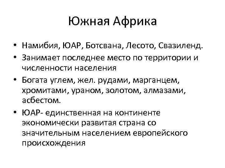 South Africa Namibia, South Africa, Botswana, Lesotho, Swaziland. It occupies the last place in terms of territory and population. It is rich in coal, iron. ores, manganese, chromites, uranium, gold, diamonds, asbestos. South Africa is the only economically developed country on the continent with a significant population of European origin.
 According to the level of socio-economic development, all African countries, with the exception of South Africa, are classified as "developing countries"
 Conclusions on the endowment of Africa with mineral resources: Africa has the richest and most diverse reserves of mineral resources. Among other continents, Africa ranks first in reserves of diamonds, gold, platinum, manganese, chromites, bauxites and phosphorites. Large reserves of coal, oil and natural gas, copper, iron, uranium, cobalt ores. Africa's minerals are of high quality and low production costs. The richest country in Africa, South Africa, has an almost complete set of known mineral resources, with the exception of oil, natural gas, and bauxite. Africa's mineral resources are unevenly distributed. Among the countries of the region there are countries that are very poor in terms of resources (Chad, the Central African Republic, etc.), which greatly complicates their development.
 African countries with the highest GDP (PPP) per capita (2010 US dollars) Gabon - 14,500 Botswana - 14,000 South Africa - 10,700 Tunisia - 9,600 Namibia - 6,900 For comparison: Tanzania - 1,500, Somalia - 600, D. Rep. . Congo - 300 world average - 11200 Africa average - 1100
 Mining in Africa Type of products Main producers of the region South African gold Diamonds South Africa, Sierra Leone, Namibia, Guinea, Botswana Uranium Niger Cobalt ores Mozambique Chromites Botswana Manganese ores Gabon Phosphorites Morocco Copper ores Zambia, Zaire oil and gas Nigeria, Libya, Algeria, Egypt, Congo, Gabon
 Conclusions on African Industry In the international division of labor, Africa is represented by extractive industry products; Production of the extractive industry has a pronounced export orientation, i.e., a weak connection with the local manufacturing industry; Among the branches of the manufacturing industry, the textile and food industries have received the greatest development.
 In most African countries, the colonial type of sectoral structure of the economy is preserved. Its distinctive features are: the predominance of low-commodity, low-productive agriculture; weak development of the manufacturing industry; a strong backlog of transport; limiting the non-productive sphere mainly to trade and services; one-sidedness of economic development
 Monoculture - mono-commodity specialization of the country's economy (narrow specialization in the production of one, as a rule, raw or food product, intended mainly for export)
General economic and geographical characteristics of African countries The mainland occupies 1/5 of the earth's land mass. In size (30.3 million km2 - with islands) of all parts of the world it is second only to Asia. The region includes 55 countries. There are several options for dividing Africa into regions. The school course proposes to divide Africa into 3 subregions: North Africa, Tropical Africa, South Africa. In the scientific literature, the five-term division of Africa is most accepted, including the North (the countries of the Maghreb, the Mediterranean coast), the West (the northern part of the Atlantic coast and the coast of the Gulf of Guinea). Central (Chad, CAR, Zaire, Congo, etc.), Eastern (located east of the Great African Rifts), Southern. There is no other continent in the world that would suffer as much from colonial oppression and the slave trade as Africa. The collapse of the colonial system began in the 50s in the north of the continent, the last colony, Namibia, was liquidated in 1990. In 1993, a new state emerged on the political map of Africa - Eritrea (as a result of the collapse of Ethiopia). Under the auspices of the UN are Western Sahara (Saharan Arab Republic. Different criteria can be used to assess the EGP of African countries. One of the main criteria is dividing countries by the presence or absence of access to the sea. Due to the fact that Africa is the most massive continent, no other of these, there are not so many countries located far from the seas.Most of the inland countries are the most backward.Africa was freed from colonial dependence only at the end of the 20th century.Now there are 55 countries on the political map of this region, all of them are sovereign states.The state system is dominated by republics , only three countries have a monarchical form of government: Morocco, Lesotho and Swaziland.Most African countries are quite large in territory.Of the features of the economic and geographical position of African countries, we can distinguish: Lack of access to the sea for most states; Access to international sea routes through the Gulf of Guinea and Mediterranean Sea Africa extremely rich in natural resources. Its main wealth is minerals. The region ranks first in the world in terms of reserves of most types of mineral raw materials. Oil and gas are mined here (Libya, Algeria, Nigeria), iron ore (Liberia, Mauritania, Guinea, Gabon), manganese and uranium ores (Gabon, Niger), bauxite (Guinea, Cameroon), copper ores (Zaire, Zambia), gold and diamonds (South Africa and West African countries), phosphorites (Nauru). South Africa is richest in minerals. There are almost all types of mineral resources (with the exception of oil, gas and bauxite). African countries are well endowed with water resources. In addition to them, Africa has a whole system of lakes (Victoria, Tanganyika, Nyasa). However, water resources are unevenly distributed: there is an excess of moisture in the equatorial zone, and there are practically no rivers and lakes in the arid regions. African countries are generally well endowed with land resources. However, as a result of erosion, a large amount of land is constantly withdrawn from agricultural circulation. The soils of Africa are not very fertile, and, in addition, demanding on agricultural technology. In terms of forest area, Africa is second only to Russia and Latin America. Forests occupy 10% of the total area of the region. These are humid equatorial forests. Currently, they are actively cut down, which leads to desertification of the territory.
 Two heads and six legs; four walk, and two lie still
 Self-esteem - what is it: concept, structure, types and levels
 Cassandra's Path, or Pasta Adventures War on Earth and Underground